3D Laser Scanning Surveys
Professional 3D Laser Scanning Surveys
Get a Free Quote From Us Today!
We aim to get back to you in 24 hours.
At 3D Laser Scanning Surveys, we specialise in delivering precise 3D laser scanning surveys across a range of building sites and structures. Our expert team uses cutting-edge laser scanning technology to capture detailed spatial data, which forms the basis for creating point clouds, measured drawings and comprehensive 3D models.
These outputs are invaluable for construction, design and planning projects, ensuring accuracy and efficiency. We proudly serve clients nationwide, providing insightful data to support a wide array of projects.
Contact us today to discover how we can assist your next project.
Who Is 3D Laser Scanning Surveys?
We’re 3D Laser Scanning Surveys, providers of high-precision 3D laser scanning services for various structures and sites. Our team employs the latest laser scanning technology, including LiDAR and terrestrial laser scanners, to gather spatial data crucial for creating point clouds and 3D models.
Using these advanced techniques, we can capture intricate details of buildings, bridges, and archaeological sites, offering millimetre-level accuracy. This data aids in the accurate planning and execution of construction and design projects, offering detailed insights and measurements.
Whether working on heritage conservation, construction planning, or infrastructure maintenance, our scans adhere to industry standards like PAS 1192 and ISO 19650. These standards ensure that our data is compatible with various BIM software, facilitating efficient collaboration among architects, engineers, and contractors.
Reach out to us to learn how our services can enhance the precision and efficiency of your projects.
What 3D Laser Scanning Services Does 3D Laser Scanning Surveys Provide?
We offer a range of 3D laser scanning services to meet diverse project needs. Our services are tailored to assist in various sectors such as architecture, construction, and engineering, ensuring precise and reliable data for every task.
- 3D Laser Scanning Surveys: We capture detailed spatial data for buildings, infrastructure, and landscapes using advanced laser technology, achieving measurement accuracies typically within a few millimetres.
- Point Cloud Production: Our team converts raw scan data into actionable point clouds. These point clouds serve as a digital representation of the scanned environment, providing a basis for further analysis and planning.
- Measured Drawings: We provide precision drawings from scanned data suitable for design applications. These drawings can assist architects and engineers in renovations, extensions, and compliance checks.
- 3D Model Creation: We develop detailed 3D models for construction and planning purposes, ensuring that every dimension is accounted for in digital prototypes. These models are invaluable for visualisation and simulation.
These services cater to clients such as architects, engineers, and project managers, helping them make informed decisions with accurate data. Contact us to discuss how we can assist with your next project.
When Is 3D Laser Scanning Needed?
3D laser scanning is typically required during the initial phases of construction or renovation projects. We use this technology to capture pre-construction site conditions accurately, ensuring that every detail is recorded for future reference.
Throughout construction, laser scanning helps us monitor progress with precision, using methods like point cloud comparison to identify deviations from design plans.
This approach is invaluable in verifying final build accuracy against the planned specifications, addressing any discrepancies before they lead to costly rework. Furthermore, 3D laser scanning is significant in heritage conservation: we document existing structures with precise data to preserve intricate details for restoration efforts.
This technology benefits various sectors, including architecture, engineering, and real estate, providing reliable data to inform decision-making. For more information, contact us today.
Get a Free No Obligation Quotation Today
How Does 3D Laser Scanning Surveys Work?
Our process is efficient and straightforward, ensuring precise results every time:
- Site Consultation: We conduct an initial consultation to understand project requirements, discussing timelines, access, and specific objectives. This helps us customise our scanning strategy.
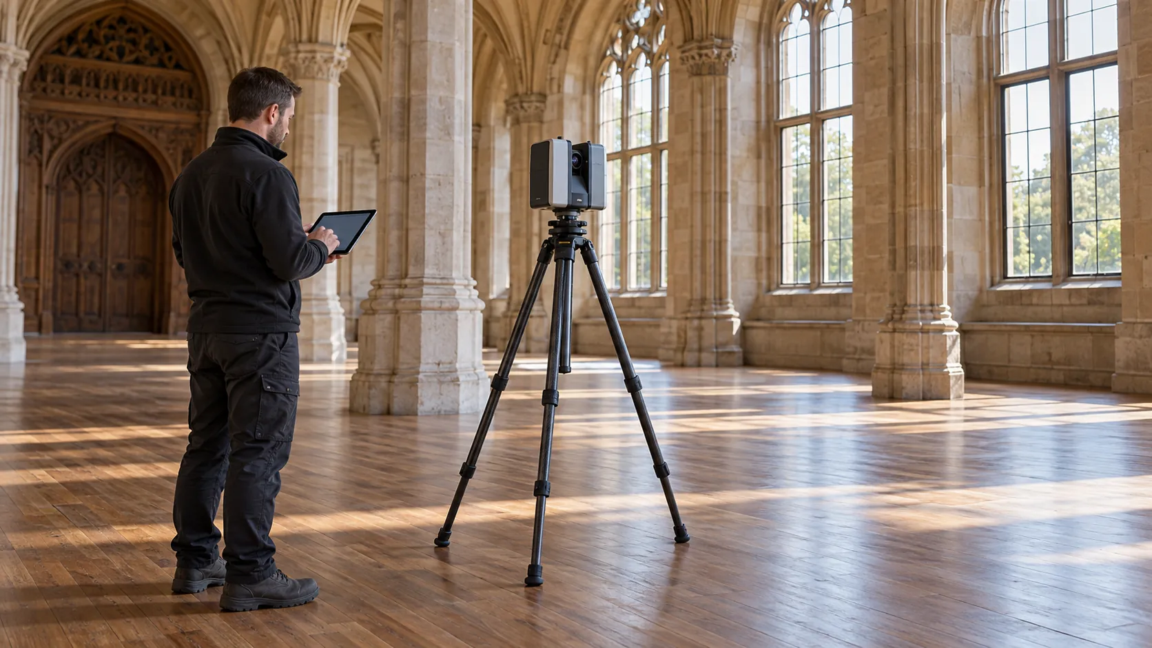
- Data Capture: Our team uses advanced laser scanning equipment, such as Leica and FARO scanners, to collect spatial data on-site. These scanners offer accuracy within millimetres, ideal for both large-scale construction sites and intricate historical restorations.
- Data Processing: The captured data is then processed using software such as AutoDesk ReCap or Cyclone, converting billions of data points into usable point clouds and 3D models.
- Final Deliverables: We provide detailed measured drawings, point clouds, and 3D models tailored to your project needs. Clients working on BIM projects will find our deliverables incorporate seamlessly into platforms like Revit and Navisworks.
Through each stage, we adhere to industry standards, including PAS 1192 and ISO 19650, ensuring accuracy and consistency. To discuss your project requirements or to schedule a consultation, contact us today.
Who Does 3D Laser Scanning Surveys Help?
3D Laser Scanning Surveys assists a wide range of clients, including architects, construction firms and design studios. Our services are invaluable in the areas of urban planning, heritage conservation and infrastructure development.
We cater to both large-scale commercial projects and smaller private developments, providing tailored solutions for each.
Our precise 3D models are essential for design verification, clash detection and retrofitting projects. Engineers benefit from our services when planning upgrades to existing facilities, ensuring compatibility with modern standards.
Surveying historic sites becomes efficient with our non-invasive methods, allowing conservationists to create accurate replicas without disturbing fragile structures.
We also work with property developers who need detailed topographic surveys and volumetric calculations. Additionally, real estate managers use our scans for property documentation and verification.
Contact us to discuss how we can support your specific project needs.
How Quickly Can 3D Laser Scanning Surveys Respond?
We aim to provide a timely response to all enquiries and project initiations. Our team employs precision equipment like the Leica BLK360 and Faro Focus scanners to ensure high-quality results.
Depending on the project’s complexity, size, and location, we typically commence the scanning process within one to two weeks of consultation. Each project is carefully scheduled and planned, adhering to industry standards such as PAS 1192 for BIM projects, to ensure accuracy and efficiency.
For urgent projects, we strive to accommodate tighter schedules where possible, often prioritising smaller residential properties or straightforward commercial spaces. After the initial scanning, data processing and analysis can take an additional few days to produce comprehensive deliverables, such as point clouds or 3D models.
Contact us to discuss your specific timeline requirements.
How Does 3D Laser Scanning Surveys Ensure Quality and Compliance?
At 3D Laser Scanning Surveys, we adhere to industry standards like ISO 9001:2015 for quality management systems. Our equipment, including the Leica RTC360 and Faro Focus3D scanners, is regularly calibrated to maintain accuracy, achieving millimetre-level precision in data capture.
Our team is trained in the latest techniques such as point cloud processing and Building Information Modelling (BIM) integration, ensuring accurate data representation.
We provide compliance-ready data that meets the specific requirements of each project, including those set by RICS (Royal Institution of Chartered Surveyors) for survey accuracy. Our detailed reports and models support various sectors, from construction and heritage conservation to industrial manufacturing.
We also tailor our deliverables to align with client needs, whether they require topographical surveys, floor plan generation, or volumetric analysis. Contact us to discuss how we can assist with your next project.
Request a free quote
Why Choose 3D Laser Scanning Surveys?
Choosing 3D Laser Scanning Surveys offers distinct advantages for your project. We provide cutting-edge solutions using Faro Focus scanners, which capture spatial data with a precision of up to ±1 mm.
This allows us to create detailed digital representations, aiding in reliable project planning and reducing potential errors.
Our services use the latest laser scanning equipment, including LiDAR systems, to ensure comprehensive data capture across varied terrains and structures. This technology benefits numerous industries, from construction and architecture to heritage conservation and engineering.
Our versatility means we can adapt our services to both large-scale infrastructure projects and smaller, specialised tasks. Whether you need a topographic survey for a new development or a heritage building scan for restoration, our team is equipped to handle it.
Our skilled professionals, certified in courses like RICS certification and TSA membership, are experienced in accurately processing collected data, leading to efficient project execution. Let us bring precision and expertise to your next venture.
Frequently Asked Questions
What is a point cloud?
A point cloud is a collection of data points defined by a coordinate system that represents the external surfaces of an object or site. It serves as a basis for creating detailed 3D models and measurements.
How accurate is 3D laser scanning?
3D laser scanning provides highly accurate spatial data with typical accuracies within a few millimetres. Accuracy depends on the equipment used and environmental conditions during scanning.
Can 3D laser scanning be used on historic buildings?
Yes, 3D laser scanning is ideal for historic buildings as it captures minute details without physical contact, preserving the site’s integrity while providing precise documentation.
Get a Free Quote
To learn more about how 3D Laser Scanning Surveys can assist your project, contact us for a free consultation and quote.
speak with our team today
What People are Saying About Us
★★★★★
“The team from 3D Laser Scanning Surveys were professional from the first phone call, turned up on time and scanned our entire warehouse in a single day. We had a detailed point cloud and accurate drawings within the week, which let the architect get on with the redesign straight away. I would highly recommend them.”
Aisha Nolan
North West
★★★★★
“Absolutely thrilled with 3D Laser Scanning Surveys, such a pleasure from start to finish. Would recommend them without a second thought.”
Naomi Nolan
Greater London
★★★★★
“The 3D Laser Scanning Surveys crew were great, really friendly and knew exactly what they were doing with the scanning. Would definitely use them again.”
Thomas Whitaker
East Midlands
★★★★★
“Excellent scanning work from 3D Laser Scanning Surveys. Highly recommend.”
Owen Sutherland
East of England
Our Locations
We are proud to work nationally across the UK, allowing us to ensure we can provide services to you.
For a full list of counties we cover in the UK, see below.